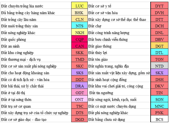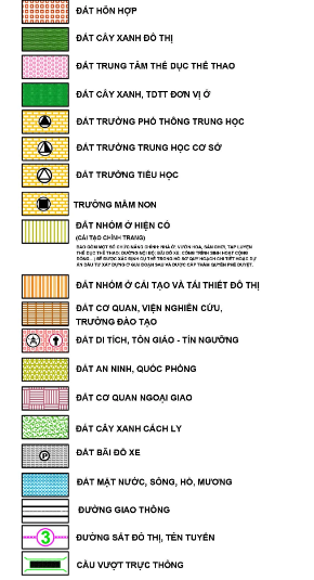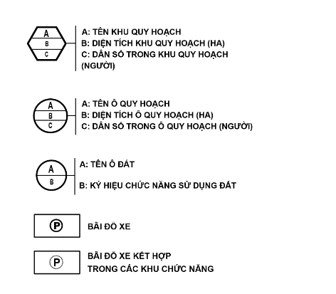


WHAT IS THE LAND USE PLANNING MAP UNDER THE 2024 LAND LAW? ANSWERS TO THE MEANING OF THE CHARACTERS ON THE PLANNING MAP
The land use plan map is an extremely important and powerful document in land management. So what are the detailed legal regulations on Land Use Planning Maps? What do the characters on the diagram mean? Let's explore the article below with Hung Nghiep Phu!